Tuesday, November 22, 2011

Southport

We made it to Wrightsville Beach from Mile Hammock.  We could have made better time if we had realized that one of the bridges (Figure 8 Bridge) that supposedly (according to our 2012 Dozier Guide) only opened on the half hour also opens on the hour.  We took our time getting to it when we should have been pushing it.  Oh, well.  That gave us one and half hours to go 5 miles to the Wrightsville Bridge.  We managed to maintain a slow pace by riding the current and sailing at .5 - 3 knots with the engine off and the jib unfurled.  That technique kept us from having to spend too much time waiting at the bridge with the current carrying us toward it.  The channel into Wrightsville was difficult to follow - at points our depth finder read 3.9 feet -- we need to calibrate it.  We think 3.9 feet means 5.9 feet giving us a clearance of .9 feet off the bottom.  We anchored near a bridge that had a resurfacing machine grinding away concrete loudly until dark.

Wrightsville itself was fun.  We saw more joggers there than anywhere else in our travels.  With all the surfers out and the surf up (and almost 70 degree temperatures) it seemed like we had been transported to Southern California.  I thought I saw 2 seals on our way in on the dinghy.  It took a moment for me to realize that seals don't wear swim caps.  Two triathletes were doing some open water swimming in their wet suits.  I would love to do a triathlon there.

After considerable double checking of current charts we set off down the ICW to Snows Cut.  Snows Cut connects with the Cape Fear River.  Our multiple checks of current charts were related to the considerable current in the Cape Fear River.  We were relieved to see that the current was against us in Snows Cut since that is an indication that the current would be with us on the Cape Fear River.
Snows Cut - a canal through ancient sand dunes

In Southport I learned a little more about
Maryanne's decision to be a vegetarian.
Rob Gandy, former City Manager of Southport is the Harbormaster at the Deep Point Marina in Southport.  He was extremely helpful with docking, transportation, and general information about Southport.  For once our landing at the fuel dock was picture perfect but our fuel system decided to rebel against the diesel fuel nozzle.  It took us 45 minutes to fill our tank as it regularly belched up diesel fuel into the cockpit. Our transom mounted fuel vent kept hiccuping fuel into a little bottle that we have suction cupped to it.  We made a decent landing at our berth in the marina. The next morning I used my bicycle pump and the air pump for the dinghy to blow out my fuel vent line.  It seems that fuel pools in a low section of the vent line.  With the line blocked, fuel bubbles into the cockpit when I try to fill the tank from the cockpit fill line.  From time to time enough pressure builds up to push fuel out of the vent.  The dinghy air pump seemed to do the job.

Downtown
We spent a lot of time exploring Southport.  The restaurants were good and the little shops for kids were fully crammed with goodies.  Our granddaughter Lucy would be very happy in these shops.

We returned to NY for a wedding - to see our grandchildren - and because Maryanne is on part time sabbatical - and has to come back to teach.  We will return to sail again in December. We're praying for a mild onset of winter this year.
Southport B&B

Some of the Southport natives can make you feel
horribly under-dressed.  I really wanted a top hat.   

One of these fairies now lives with our granddaughter in NY
A candidate for figurehead
under our bowsprit.
Could they fit any more stuff in here?


One of the reasons we flew back to NY
Our nephew's wedding in Newport.
Congratulations Courtney & Evan!
Evan and his brother Adam are up to  BIG things
http://www.imdb.com/title/tt2081274/
2 more reasons to go back to NY
Juniper & Lucy

Saturday, November 12, 2011

Oriental (Nov. 2- Nov. 6)

Oriental was one of the nicer towns that we have visited on this cruise.  We stopped at Deaton Yacht Service.  Our charts showed a channel leading into Whitaker Creek where Deaton is located but no information on the depths in the channel.  All around the channel were depths of 3 to 4 feet - not enough for our 5 foot draft.  A short conversation with a worker at Deaton gave us some instructions on how to get in and reassurance that several boats with 6 foot draft had come in earlier that day.  Gingerly, we headed down the channel.  Just as we had been told the water was good.  When we got closer the worker, Buddy, told me I would have to back into my slip.  I asked which side should I have my fenders and lines on for docking.  "Don't worry," Buddy said, "You don't need them - we'll just catch you."  I'm embarrassed to admit that then I may have told him I loved him!  The docking was a little nerve wracking but he and his crew made it almost easy.  Buddy, it turns out, is part of the management team at Deaton's.  Everyone there was not only professional and helpful, they were also friendly.  When I asked Buddy a question about my anchor windlass he encouraged me to go to work taking it apart and doing some preventative maintenance.  If I had any problems he assured me that he would be happy to help.  I struggled with several corroded sticking parts but eventually got most of it apart.  The last two pieces were beyond me.  Buddy researched the windlass on the internet and spent considerable time with me in the shop pounding the the two pieces apart with a mallet.  He gave me instruction on which parts to lubricate with which type of lubricant and gave me some solvent for some of the smaller pieces.  All of the cruisers that I met with various problems at Deaton's (including one who had to be towed in) all agreed that if you were going to have a  problem with your boat you that Deaton's was the place to be.
Maryanne at The Bean - great coffee shop
 

Places that we liked in Oriental: The M&M cafe where I had my first shrimp, sausage, and grits dinner.
The Silos - tasty Italian food.  The Bean - (only recently opened after Hurricane Irene this summer) good coffee and excellent hot chocolate.  The Marine consignment store with an infinite variety of items.  The free municipal dock (where you better arrive early for one of the 2 berths).  And we loved the homes - all beautifully kept all the way from the Boat yard to downtown.
One of the many lovely homes in Oriental

Outside of town there is some blight and poverty -
probably true for most communities.


There are no tides in Oriental but the water does rise and recede based on the wind strength and direction.  The gale force winds that forced us to stay in Oriental, flooded some of the streets in town and covered the town dinghy dock.   When we went to bed our deck was even with the dock.  When we got up in the morning the dock was even with our waterline.  The water was just about lapping at the bottom of the dock.  This is what is called a wind tide.  This type of tide could be a real problem when we are trying to pass under a bridge with what should be 65 foot clearance. The clearance could easily be reduced to 61 feet.  At 61 feet our mast might not clear the bridge.

Cruisers take note - I could find no fuel in Whitaker Creek.  I had to make 3 trips with the loaner car to fill my 2 diesel jugs enough times to fill my tank.
Partially submerged dinghy dock - a result of the gale force winds

Tuesday, November 8, 2011

Swansboro - Monday 11/7/2011

Swansboro Police Station & Water tower
Seven hours of motoring and motor sailing brought us down Adams Creek, past Morehead City and along Bogue Sound.  Our cruising guide warned us of narrow channels along Bogue Sound and "hard" edges that could easily put us aground.  The cruising guides are designed to make sure that Maryanne doesn't get too comfortable with our cruising routine.  The guides have warnings galore.  Again we saw dolphins and pelicans on our way out of a canal into the harbor behind Morehead City.  We also saw a Harrier jet loud enough to make our teeth rattle.  It seemed to be practicing hovering near some trees in the distance and landing.  Then it rose slowly out of the trees and took off like a rocket.

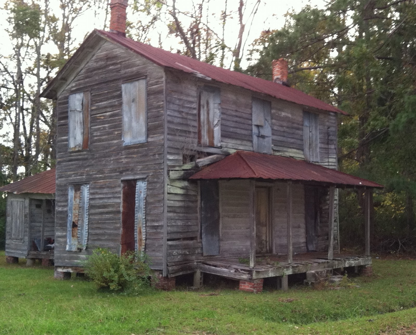
These guys were working on this house next to
Dudley's Marina when we arrived.  This does
not look like a stress-free job to me.
Rather than anchor in the currents in Swansboro we decided to take it easy and stay at a 75 cents per foot dock at Dudley's Marina.  Once again I displayed my incredible docking skill, turning the bow into the current that was carrying us sideways away from the dock.  I manage to quickly throw a bow line and then a stern line to the line handlers on the dock as I began drifting away.  Fortunately, they got a good hold on the lines.  Unfortunately, my stern line was over the top of my stern rail so that if the line were pulled too hard it could bend the rail.  I also learned during this docking experience that when I leave the helm I should put the engine in neutral.  Leaving it in reverse makes it so much harder to pull the boat in!  It's something like parking your car and leaving it in reverse.  Oh, well...some quick instructions to Maryanne had our boat in forward gear to correct the problem and then in neutral as we were pulled in.  I swear I will get this docking thing right before the end of the cruise.

I love mermaids and figureheads.
this one was on the Mercantile,
a store in Swansboro.  We want
to spend more time in Swansboro
on the way back.
Maryanne has been perfecting her acrobatic skills at Dudley's.  To disembark she climbs over the lifelines and stands on the rail.  From there she steps atop a piling and then steps down onto the dock.  I'm trying to encourage her to spend more time atop the piling posing but she's not very enthusiastic.  She has a tendency to make rude remarks whenever I give her  my clever suggestions.

We met up with Marie, Francois, and Mario at Dudley's.  They had been at Deaton's yacht yard with us waiting out the gale warnings on their two boats.  Maryanne and I surprised them with her fresh baked (from scratch) chocolate chip brownies at Dudley's.  They were not just impressed with the delicious brownies.  They were amazed at our timing.  They had just been talking to each other about needing a good desert when I showed up with the brownies.  The next day Marie left a can of Canadian pure maple syrup in our cockpit as a thank you.

Clyde greeted us out in front of Dudley's
We had hoped to motor from Swansboro to Wrightsville Beach but our new friends Francois and Mario told us about the restrictions on the bridges that we need to have open for us.  The bridges are set to open up on the hour or hourly half past the hour.  You are guaranteed not to make some of those openings if you travel at 6 knots as we do.  Those kinds of delays could have us out in the middle of nowhere in the dark with no place to anchor.  Maryanne really doesn't like those kinds of situations.
Swansboro - we are surrounded by miles and miles of marshland.


We decided to head to an anchorage called Mile Hammock next to Camp Lejeune.    The Cruising Guide warned about possibility of live fire exercises in which the marines shoot across the ICW.  Those exercises could cause some serious delays also.  We were lucky - there were no flashing lights or other signs that live fire was taking place.

STOP DO NOT PROCEED
Live Firing in progress when flashing
Tune to AM 530
The guides warned that Mile Hammock might not be a very tranquil area to anchor since the Marines may be doing various night exercises or amphibious landings.  In this case the guides were correct.  The anchorage had a number of camouflage colored boats practicing landings on the dock when we arrived at 2 pm. This evening helicopters practiced night landings and hovering near us in the woods. They came roaring over the boats in the harbor a little above mast height for several hours. We thought the noise had finally stopped when I heard a boat bang into me in the crowded little harbor. When I ran up on deck there was no boat near me.  Just then another loud boom sounded - bombs being exploded in the distance. The sound carries through the water and our hull as though we are being hit. Just another relaxing day of cruising.
http://www.youtube.com/watch?v=HkRw8QtHxTA


Sunday, November 6, 2011

Pasquotank River - Elizabeth City

Our son Chad (cruisingsabbatical.com) told us that he saw another Caliber 40 on a dock in the ICW a few miles before the docks in Elizabeth City.  It looked something like this:

Our guest slip next to Paul & Joyce's Caliber "Time"
It turns out that we had met the owners of this Caliber 40 at a Caliber Cruising Club meeting in 2008.  After a brief email exchange and a phone call we received an invitation to stay on their dock.  The timing was great - we were in their neighborhood and the forecast like the Swamp was dismal.  We had a great time at Paul and Joyce's - dinner with their neighbors - and dinner with 2 other cruisers heading south.  Their home is absolutely lovely.  They outdid themselves helping us provision.  Paul is an encyclopedia of knowledge about Calibers.  Bill and Sue on a power boat, and Ed and Joann on another Caliber also had a wealth of knowledge about cruising in the Bahamas.  By the time we were ready to leave, there were 3 Calibers in the slips. (We weren't really ready to leave - we loved our stay so much we wanted to winter there!)

Here is the same dock with 3 Calibers shot from shore.
One is hidden behind the old Cypress tree.  The roots of
these trees don't rot very much under the water.   When the
tree is gone the sharp roots stick straight up in the water.  You
don't want to hit them with your boat or find your anchor in them
when you are ready to leave your anchorage,

We found these 3 ladies flying in front of  Paul & Joyce's house.
They were dubbed the 3 J's  - coincidentally Joyce begins with
a J as does her neighbor Julia.  No, it has to be a coincidence -
Joyce and Julia are way too nice!


The 3 J's pet?  Who knew it was endangered?

Paul and Joyce came down before dawn to say goodbye.
The water in the Dismal Swamp Canal and in the Pasquotank River is a brownish tea color from the decaying vegetation in the swamp.  Paul told us that British ships used to come up the river for this water because it is slightly acidic and because it would last up to 2 years in a cask without going bad.  For the old sailing ships this water was highly prized.  
A view we will always prize: a chilly dawn on the Pasquotank River - time to depart.

Friday, November 4, 2011

Norfolk and the Dismal Swamp

These cranes looked like giant transformers to us.
For several miles beyond Waterside Marina the waterfrornt
looked like an industrial sci-fi movie set.  Not very pretty.
Miles and miles of huge cranes.
Above: Our berth at Waterside.  On our port side is the
 Ferdinand Hassler, a NOAA research vessel which will be stationed
in New Castle, NH.  In the background you get a sense of how
industrial this area is.
(10/27 & 10/28/2011)
We had read that people leave Waterside Marina and the nearby anchorage at Hospital Point before dark to get through the Gilmerton Bridge (about 45 minutes away) for the 6:30 opening.  If you miss it you have to wait until the end of rush hour at 9:30.  Hanging out motoring around in circles with a bunch of other boats in the dark for 3 hours just isn’t that much fun.  We had also heard that there is often a mad dash when one of the usually open railroad bridges closes.  As soon as the bridge opens everyone pushes as fast as they can to get to the Gilmerton Bridge.  It took us a little while to realize that we did not have to participate in that madness.  We could easily leave the marina at 8:30 in full daylight, make the 9:30 opening and then make the 11:00 am lock opening to get an eight foot lift to the Dismal Swamp Canal.  Despite what seemed like an interminable 20 minute wait at a closed railroad bridge we were early to the Gilmerton Bridge.  Boats began collecting there until there were 21 of us waiting to get through.  I was surprised to see how we all managed to find our places in a single file through the bridge. 

Two years ago my son nearly missed the right hand turn into the Dismal Canal so I was ready after we cleared the bridge to make the turn.  I saw the branch of the river to the right and the red marker to keep to the right and headed for it.  Big mistake.  There were two red marks – I had failed to see the first one that formed a gate with a green mark.  Two boats behind me turned right before I recognized my error.  I spun the wheel to the right and headed for the gate.  If I had continued to the second mark I’m pretty sure I would have noticed that rounding it would have put me in the woods.  Still, I felt pretty dumb.  But I had company – a boat ahead of me went even further than I did before he corrected.  For some reason that made me feel better.  Misery loves company – or is it dumb loves to see dumber?
Here we are waiting to drop 8 feet.

Here we are a few feet lower
ready to head to the Pasquatank River.
Expert line handler Maryanne is obscured
by the mast and the cockpit enclosure.
We were a little apprehensive about the Dismal Swamp Canal.  We were told that it was shallow and it was easy to run aground.  We had also been told that if you are not careful you will lose your mast top anemometer and wind point indicator to overhanging tree branches.  To add to those hazards there were supposedly many logs and floating tree branches to avoid.  Going through locks was also something new to us and another source of worry.  We heard enough positive things about the beauty  of the Dismal Canal that we decided to take our chances.  The Canal was very different than any other boating experiences we have had.  The history of the canal was interesting too.  George Washington had suggested building it years before it was dug by hand by slaves.  The slaves used their familiarity with the area to escape and even established small colonies in the swamp.
An early morning view of the Dismal Swamp Canal from the Visitor Center